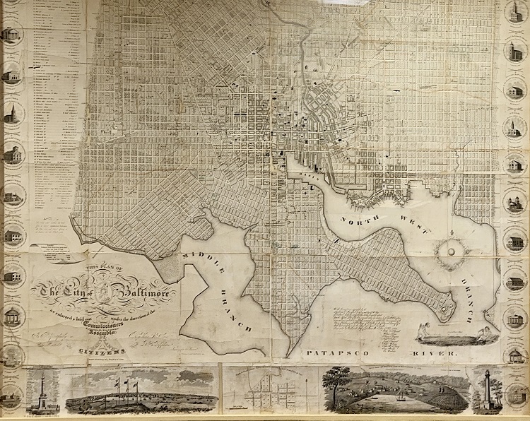
This 1822 map of Baltimore reflects the city's growth under Commissioners in 1818. Between 1776 and 1820, Baltimore expanded from three merged settlements to an area consisting of 14.71 square miles. As commerce thrived, fueled by shipping, both legal and piratical, the city's population surged from 6,000 to 63,000. Over 14,000 of Baltimore's residents were enslaved and free blacks.
Risk-taking merchants in Baltimore speculated in bank stocks, causing a depression from 1817 to 1820. The post-Revolutionary and pre-War of 1812 period posed challenges for land surveyors trying to establish property ownership amidst a building boom. Despite legislative efforts in 1784, a detailed map only emerged on the eve of the War of 1812.
At the time this map was created, North Avenue was the northern most boundary of the city. The area to the north consisted of farm fields and orchards. Today, North Avenue is an east-west thoroughfare in the middle of downtown Baltimore. Come look at this 1823 map for a glimpse into the history of the expansion of Baltimore.