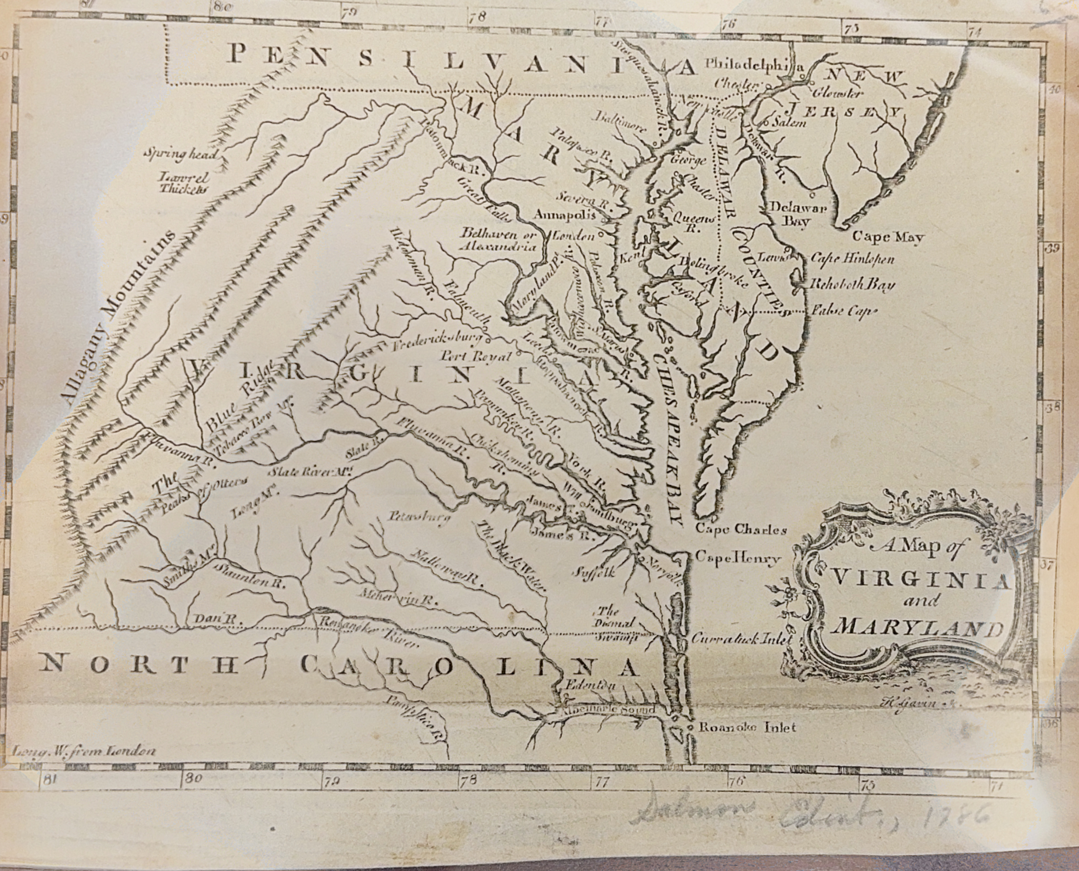
This 1767 map of Maryland and Virginia by Hector Gavin features towns and rivers east of the Allegany Mountains. The following towns are featured: Williamsburg, Bethaven, Alexandria, Annapolis, Baltimore, Fredricksburg, and Norfolk.
Hector Gavin was an influential 18th-century cartographer known for his detailed and accurate maps of American colonies. Operating during a time when precise mapping was crucial for navigation and territorial claims, Gavin’s work contributed significantly to the understanding of colonial geography. His 1767 map of Maryland and Virginia, for instance, is celebrated for its clarity and meticulous detail, reflecting both his skill and the era’s cartographic advancements. Gavin’s maps are valued not only for their practical utility but also for their historical insight into the colonial period.

