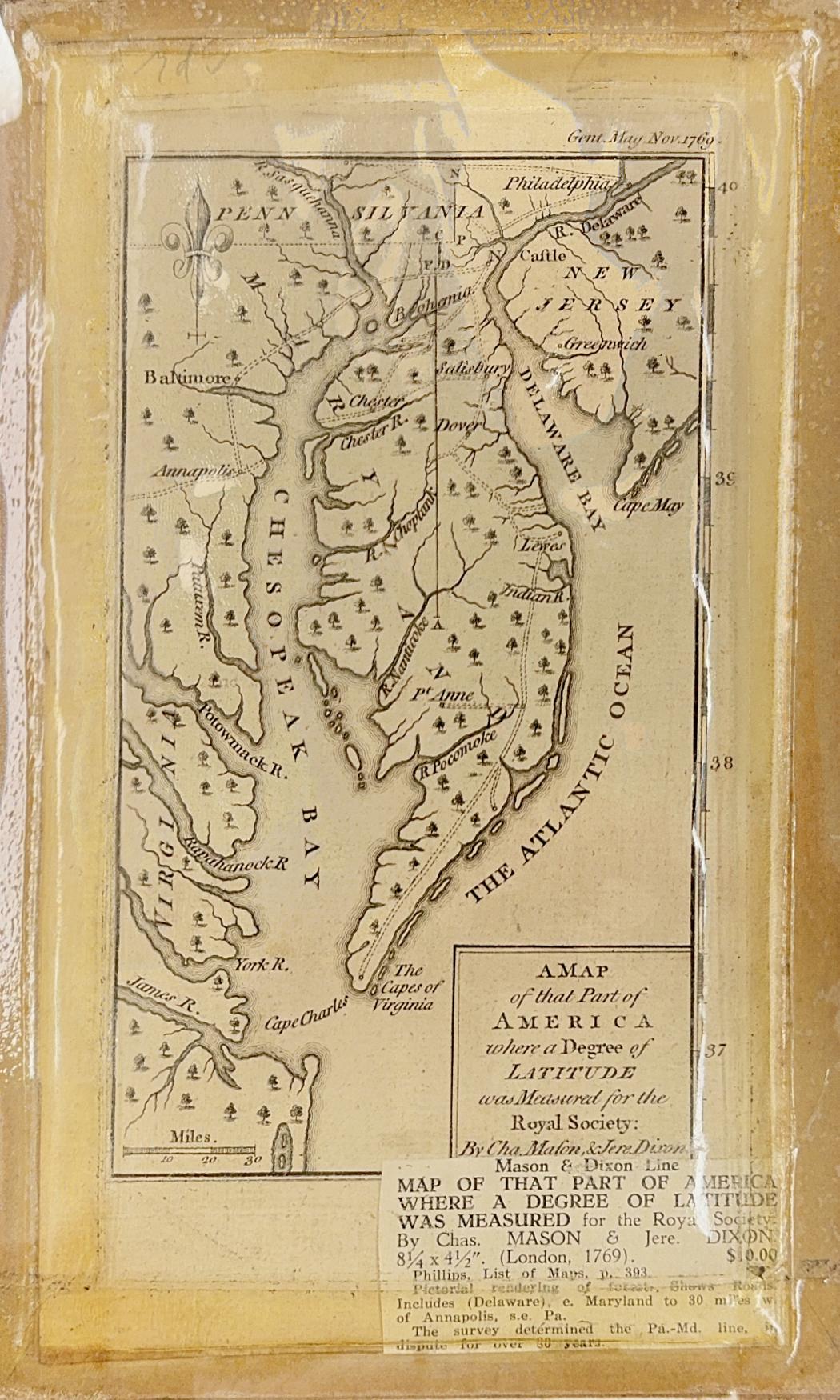
Born as the result of a bitter territorial dispute over royal land grants, the Mason-Dixon Line was surveyed between 1763 and 1767 to settle the boundaries for Pennsylvania and Maryland. Appointed by the Britain’s Royal Society, Charles Mason and Jeremiah Dixon perform the survey. The results appear in "A Map of that Part of America where a Degree of Latitude was measured for the Royal Society."
The map shows the east coast from the James River at the south to the Susquehanna and Delaware Rivers at the north and including our own Chester River. This map and a technical discussion about measuring longitude was published in London in the December 1769 issue of “The Gentleman’s Magazine," an indication of which can be seen in the upper right corner (Gent. Mag. Nov. 1769).