Simon Martenet (born 1832) was a surveyor, mapmaker and real estate consultant. In 1864, Mr. Martenet secured the cooperation of the state in the form of a legislative resolution [No. 2, Assented to March 9, 1864], which granted him "the free use of the State Library . . . and such other Archives and State Records as may contain applicable data . . . which may assist him in perfecting his proposed Map of Maryland; and the various State officers are requested to furnish him every facility for the accomplishment of that object."
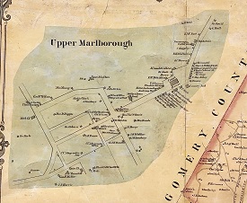
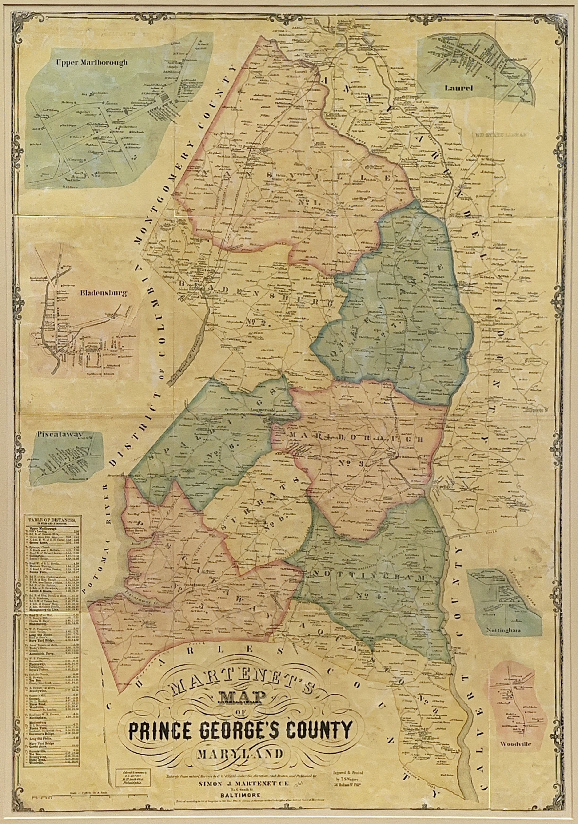
By 1867 he had published an atlas and a large map of Maryland that was so accurate that the General Assembly provided copies for all the public schools in the state. Produced prior to his state map, Martenet's Map of Prince George's County, 1861, features insets of Upper Marlborough, Bladensburg, Piscataway, Laurel, Nottingham and Woodville. Martenet's maps and atlases in the collection of the Maryland State Archives span the years 1858 to 1886, but it is likely that his maps were produced and sold up to the time of the Great Baltimore Fire, February 7-8, 1904.